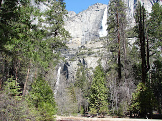
Another view of both the Upper and Lower Yosemite falls.
A closer shot of the Upper Falls.
On the way out we saw this information and had to wait for a Pilot car to escort us past the burning area.
The fire looked a little rambunctious near the top of the peak!
Wednesday, April 16, 2008
Wildlife on the trail.
This a Western Gray Squirrel, larger than the our Eastern Gray and the tail is much bushier,
I think this is a Red Squirrel. It is smaller than the Eastern Gray Squirrel.
This is a Western Blue Jay. A more brilliant blue than our Eastern Jay
This wildlife is Barbara at the foot of Lower Yosemite Fall.
I think this is a Red Squirrel. It is smaller than the Eastern Gray Squirrel.
This is a Western Blue Jay. A more brilliant blue than our Eastern Jay
This wildlife is Barbara at the foot of Lower Yosemite Fall.
More Yosemite
Bridal Veil falls
The famous upper and lower Yosemite falls
The trail to the lower falls. It was about 45 degrees this day. There is still snow on the ground in the shady spots up here.
The famous upper and lower Yosemite falls
The trail to the lower falls. It was about 45 degrees this day. There is still snow on the ground in the shady spots up here.
Oakhurst and Yosemite, CA
This a covey of Gambel quail that was walking across the other end of the RV park. There are lots of these type quail in this area.
Just behind the RV in the above picture is this waterfall, this stream runs by our camping spot.
Once into Yosemite we ran into this prescribed burn. It was about 8am and the smoke was hanging low. This fire was first set a week ago! They plan to burn 2,ooo acres to protect a small settlement near the Park.
This is our first look at the famous waterfall. Many waterfall pictures follow.
Tuesday, April 15, 2008
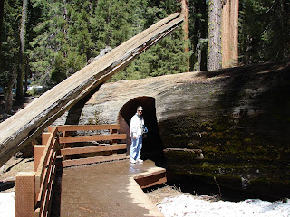
We make it up to the big one!
A fallen log along the path.
Click on the picture above and see if you can read it.
The one in the center is the big one.
This will give you some idea of just how big this tree is! I thought I might ask a Ranger if we could have equal time and call the tree the General Lee every other year, but I decided that might be a waste of my time!
Coming out of Death Valley
We start to see water!
Then we see orange groves and they were blooming. Oh, what a sweet smell!
And we begin to see grape fields.
Then we see orange groves and they were blooming. Oh, what a sweet smell!
And we begin to see grape fields.
More of Death Valley
The lowest area has salt flats.
The road crosses the salt flat.
Coming out of Death Valley on the west side is beautiful mountains.
And more Joshua trees that we saw in Joshua Tree National Park! Death Valley is unique, but we were a little late in the spring to stay overnight. We thought the cats would have gotten too hot during the day while we toured around in the car.
We arrive at Death Valley.
The entrance sign.
Barbara at the museum.
This is the first time we have been below sea level and still be dry. Actually that is not the true as we were beginning to sweat as it was starting to get hot!
Heading west.
Barbara at the museum.
This is the first time we have been below sea level and still be dry. Actually that is not the true as we were beginning to sweat as it was starting to get hot!
Heading west.
Monday, April 14, 2008
From Vegas to Death Valley
Before we left, Izzy the younger cat fleeced her bird toy, it must have been fun!
These are in route pictures.
These are in route pictures.
While at Vegas we toured Hover Dam and Lake Mead
Picture taken from the dam. Note the normal water level would be at the top of the white mineral stained area. The lake is about 125 feet low now. It has been low for about 10 years, but it went lower during the drought of the mid 50s. Some of us remember those dry times.
Barbara on the top of the dam. Note the bypass bridge being built behind the dam. As of now tractor trailers can not cross the dam, a result of 9/11/2001! The cost of the bridge is a hidden cost of 9/11!
The water coming out of the power plant.
Subscribe to:
Comments (Atom)


